Urban simulator - SIENA
- The text on this page is taken from an equivalent page of the IEHIAS-project.
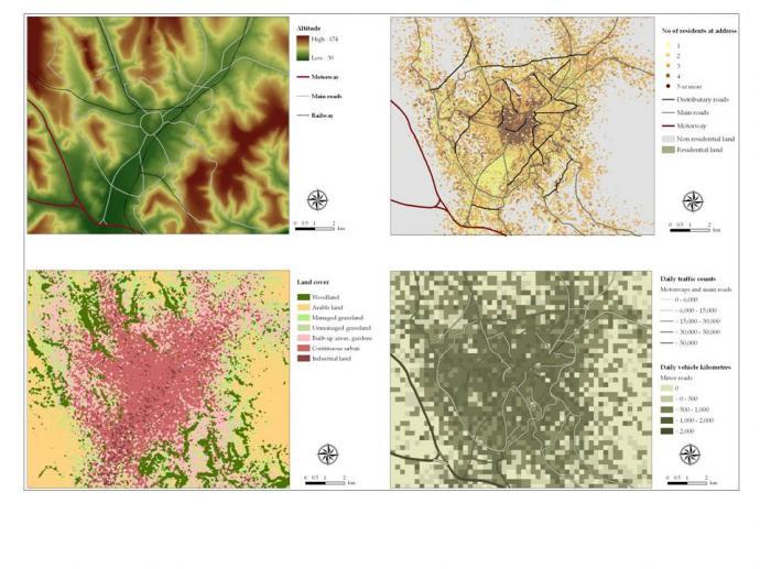
SIENA is a GIS-based urban SImulation for ENvironmental health Analysis. Its purpose is to provide a user-controlled system in which to simulate and explore the ways in which environmental factors affect human exposure to risk factors, and how these might change under different scenarios.
It thus provides a valuable tool for integrated environmental health impact assessment, for example by:
- helping to develop and test models under conditions that the user can control;
- investigating the spatial processes and relationships operating in urban areas;
- exploring the ways in which environmental health scenarios might play out within an urban setting
SIENA represents a medium-sized city of between 100,000 and 500,000 inhabitants. It incorporates data on a range of environmental factors (e.g. topography, transportation network and land cover) and the population. The spatial patterns and relationships depicted in SIENA have all been based on generalisations from a number of real-world cities in Great Britain.
As well as the basic environmental and population data, the system includes a range of thematic data (e.g. traffic emissions, mobile phone masts, air pollution monitoring network). Other data may be generated within SIENA, while supplementary data can also be incorporated from external sources for specific applications by following simple instructions.
The fact that SIENA is based on an amalgamation of cities helps to ensure that its results have general applicability. Nevertheless, it needs to be remembered that SIENA simulates an urban system and is therefore not directly representative of every real-world setting. Instead, results need to be interpreted as indicative of what is likely to happen in the real-world.
More information about SIENA, including examples of its application and a link to download the data, can be found here.
